Mt. San Jacinto Summit, Up By Trail, Adventure Route Back.

About this Event
Mt. San Jacinto Summit, Up by Trail, Adventure Route Back.
About This Event
If you have never hiked to the summit of Mt. San Jacinto, this may be your chance to get there. With qualified guides, we’ll follow the well-maintained standard trails to the top, allowing you to concentrate on the scenery, your pace, and the experience of climbing one of Southern California’s great mountains.
Along the way we’ll stop for snacks and hydration at lush Round Valley Meadow, where we may encounter some of the mountain’s resident mule deer quietly grazing while keeping a watchful eye on us.
Our next rest stop is Wellman Divide, where the landscape suddenly opens to expansive views. Tahquitz Peak Lookout is prominent to the south, with mountain ranges stretching toward Palomar Mountain in San Diego County.
Nearby, a spring supports a spectacular seasonal garden of mountain wildflowers, including Corn Lily and the beautiful endemic Lemon Lily. We won’t have time for that detour on this hike, but it’s a place worth remembering for a return visit when the flowers are in bloom.
From Wellman Divide, the trail gently traverses a broad, open slope as we continue toward the high country—and right past the base of Miller Peak.
Remember Miller Peak. We may be coming back.
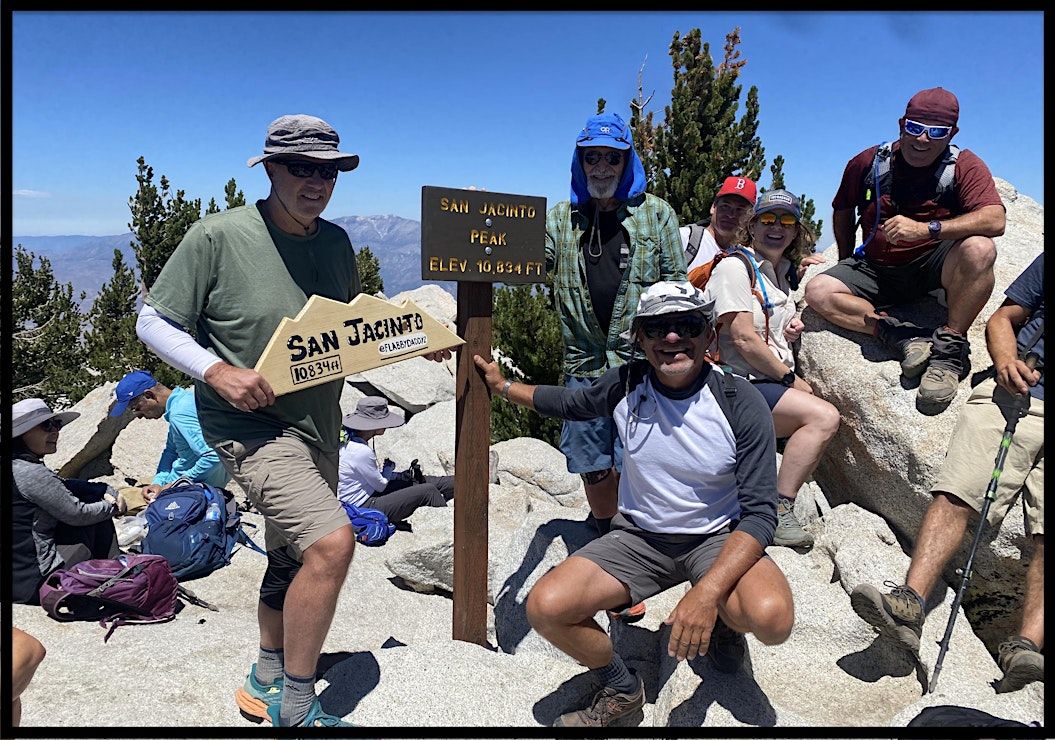
From there, we continue toward our main goal: Mt. San Jacinto, elevation 10,834 feet, the highest peak in the Peninsular Ranges and the second-highest peak in Southern California.
John Muir famously described the view from San Jacinto as “the most sublime spectacle to be found anywhere on this earth.” When we reach the summit, we’ll take time to enjoy the serenity, the remarkable 360-degree views, lunch, and conversation with our fellow hikers.
And Then the Adventure Begins
Going up, we know exactly where we’re going. Coming back, perhaps not.After summiting Mt. San Jacinto, Jack may invite those who wish to make a short detour to the summit of Miller Peak. It’s a quick scramble with a dramatic payoff: a striking view down the mountain’s steep northern escarpment that few San Jacinto hikers ever see.
From there, Jack and Kathryn will select a return route suited to the abilities and interests of the group. Portions may leave the maintained trail and pass through seldom-visited areas of the mountain.
The descent should require less sustained climbing than our trip to the summit, but don’t mistake that for an ordinary walk back. Off-trail travel can require balance, agility, careful footing, and a willingness to explore.
The trail gets us to the summit. The adventure gets us home.
Optional Reading: A Few Mountain Stories
Miller Peak
Miller Peak is easily overlooked. It lies just off a sharp bend in the main trail and is passed unnoticed by most hikers on their way to San Jacinto Peak.
A short scramble leads to a dramatic precipice and two plaques honoring its namesake, Free ank A. Miller, founder of Riverside’s Mission Inn and an enthusiastic supporter of the Boy Scouts—once described as a “champion of boyhood.”
When Miller Peak was dedicated shortly after his death, more than twenty Boy Scout troops reportedly climbed high peaks throughout Southern California and simultaneously lit commemorative bonfires.
Imagine getting that fire permit today!
Cornell, Marion and Jean
Other familiar names on the San Jacinto skyline have interesting origins.
Cornell Peak, elevation 9,750 feet, was named by U.S.G.S. geologist Robert Hill for his alma mater, Cornell University—one of the three Ivies represented on the mountain, along with Harvard and Yale.
U.S.G.S. topographer Edmund Perkins Jr. named Marion Peak (10,362 feet) and Jean Peak (10,670 feet) for two women in his life in 1897. Marion taught school on the Morongo Indian Reservation, while Jean, whom Perkins met in Northern California, eventually became his wife in 1903. Marion may have had the last laugh, however: an entire ridge was later named for her.
And San Jacinto itself takes its name from the Spanish form of Saint Hyacinth, the 12th–13th century Polish Dominican priest and missionary.
Hike Details
Date and Time: Sunday, September 6. We depart promptly at 8:45 a.m. and expect to return at approximately 4:00 p.m. for on time help. discounts and Membership
Meeting Place: Long Valley Ranger Station. From the ground-floor terrace of the Mountain Station, proceed down the ramp into Long Valley. At the bottom, turn right and follow the trail to the picnic table at the Ranger Station.
Difficulty: Strenuous. Approximately 12 miles, with about 2,500 feet of total elevation gain.
Elevation: Approximately 8,350 feet at Long Valley to 10,834 feet at the summit. At this elevation, the reduced oxygen can make physical exertion noticeably more demanding. If you are unfamiliar with hiking at high altitude, consider spending some time at elevation before the hike.
Hiking Time: Up to 7–8 hours, including breaks.
Tram: Take the 8:00 a.m. tram car in order to arrive at the meeting location on time. Please see our website for important information about parking, purchasing Tram tickets, and arriving on time. NHA members receive a 20% discount on Tram tickets.
Requirements
Each participant must register individually and must be physically prepared for a strenuous hike lasting up to eight hours at high elevation. The group’s pace will necessarily be influenced by its slowest member.
Every person attending must register under his or her own name. Please do not register twice under one name for two participants. A duplicate name will not be recognized as a separate registration and may be cancelled.
All participants must sign the before departing. You may review it online in advance; the hike leader will have a copy available for signature at the meeting location.
What to Bring Bring a minimum of 3 liters of water per person, lunch, trail snacks, and a daypack containing the usual essentials for a full-day mountain hike. Energy snacks can make a significant difference in maintaining your strength throughout the day, so come well supplied.
Wear proper hiking clothing, including an extra layer, sturdy hiking boots with good soles, rain protection, a hat, and sunglasses. No tennis shoes, please.
Hiking poles are strongly advised, particularly because portions of the return route may be off trail.
Age: Minimum age is 14. Anyone under 18 must be accompanied by a legal guardian.
Questions?
Contact hike leader Jack Pensegrau at [email protected] or [email protected].
Where is it happening?
Event Location & Nearby Stays:
USD 0.00