State of the Watersheds: Metro Atlanta Urban Watersheds Symposium

About this Event
2026 Symposium : "Watersheds Rising: People, Purpose, and Power."
Our 5th Annual MAUW Symposium will highlight environmental activism, with a particular emphasis on environmental justice and climate change, in conjunction with community organizations.
Engage in panel discussions, breakout activities, and network with other stewards of our watersheds!
KEYNOTE SPEAKERS/PANEL:
Join us for our Community Panel about the beginnings of the environmental justice efforts of key watershed activists to learn about the history of Atlanta's watersheds, and hear from the people responsible for the birth of the Urban Watershed Movement.
Experience our morning keynote with Dr. Rachel Scarlett from Georgia State University to discuss "Living with Water: Navigating Barriers to Community-Engaged Stormwater Governance."
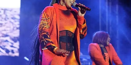
Wrap up the day with our evening Keynote Speaker, Co-Exectuive Director of the Bayou City Waterkeeper, Ayanna Jolivet Mccloud.
BREAK OUT SESSIONS:
Environmental Education:
Title: Learning Connections to the Watershed with Hands-on Modeling
You do not need to physically be at the creek to learn about watersheds. Join this session to discover how to use various interactive models such as Enviroscape and the EPA website to demonstrate Atlanta’s watersheds to the community you serve in classrooms, outreach events, or more. Whether you have used an interactive model before or are looking for new ways to engage an audience, let this session guide you through key watershed concepts and exploration of how water moves through a local watershed.
Environmental Stewardship:
Title: Mapping “Flood”-lanta
Atlanta is ‘known’ for its heat. Within recent years, Atlanta has been nationally known for other climate events- Flooding. Every year the storm reports get more intense, and so do the community's voice in storytelling of planning, enduring, and surviving. Join us in this session to share and map flooding in your watersheds. Engage in a mapping activity surrounding flooding and the conversations that can be held with different stakeholders in the community. Compare where neighbors notice flooding, where it has been mapped, and watch how demographics and infrastructure add to the conversation!
Environmental Justice:
Title: Organizing Collective Movements: People, Purpose, + Power
The 2026 MAUW Symposium EJ Breakout Session seeks to build on the power-building/ strategy EJ workshop from the 2025 MAUWS, as well as current movements drawing upon collective power to shape local policy. By engaging panelists from various collective movements, we will explore best practices and postures to sustainable and equitable movements with measurable impact.
PLEASE complete your registration by Monday, October 19th!
STUDENT POSTERS/COMMUNITY PRESENTATIONS
Do you want to be featured in this year's MAUW Symposium? We are seeking student and community submissions for watershed-related research, stories, media, etc., related to community, air, soil, or water within metro Atlanta. We are accepting submissions on a rolling basis until Wednesday, October 7th 11:59 pm EST.
Student Registrations MUST be done with student email!
SUBMIT HERE!!!!
Agenda
🕑: 08:30 AM
Doors Open
Info: Doors open to event.
🕑: 09:00 AM - 09:30 AM
Breakfast
Info: Continental Breakfast & Networking
[Human Bingo (Urban Watersheds Edition)]
🕑: 09:30 AM - 09:45 AM
Welcome/Opening
Info: Land + Labor acknowledgments, and State of Our Watersheds introduction
🕑: 09:45 AM - 11:00 AM
Session 1: Community Voices: Genesis of an Urban Watershed Movement in Atlanta
Info: Join us for an in depth Panel Discussion about the beginnings of the environmental justice efforts of key watershed activists. Learn about the history of Atlanta's watersheds, and hear from the people responsible for the birth of the Urban Watershed Movement. Moderated by Darryl Haddock.
🕑: 11:20 AM - 12:10 PM
Session 2: Morning Keynote Speaker
Host: Dr. Rachel Scarlett
Info: Join us to hear from Dr. Rachel Scarlett from Georgia State University in Session 2: "Living with Water: Navigating Barriers to Community-Engaged Stormwater Governance."
🕑: 12:15 PM - 01:25 PM
Lunch, Interactive Activities, and Vendor Networking
Info: Engage with Student Poster Session & Artistic Representations , Watershed Stories , Greenspace Wellness Activity, and Networking !
🕑: 12:45 PM - 01:15 PM
Student Posters and Community Presentations
Info: Gather in the lobby area to see student posters, community presentations, and see the work happening in the watershed!
🕑: 01:35 PM - 02:25 PM
Session 3: Breakout Sessions
Info: Join each Department for Interactive Breakout Sessions: /// Environmental Stewardship: Mapping "Flood"-Lanta /// Environmental Education: Learning Connections to the Watershed with Hands-on Modeling
/// Environmental Justice : Organizing Collective Movements: People, Purpose, + Power
🕑: 02:35 PM - 03:50 PM
Session 4: Closing Keynote Address + Call to Action
Host: Ayanna Jolivet Mccloud
Info: Join us with the Co-Executive director of the Bayou City Waterkeeper, Ayanna Jolivet Mccloud to learn about her work and her impact within her City's watersheds.
🕑: 03:50 PM - 04:05 PM
Close Out
Info: End the day with us as we wrap up and head home!
Where is it happening?
Event Location & Nearby Stays:
USD 25.00 to USD 75.00