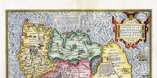
Ireland: Mapping the Island - a Tale of Trade, Conquest and a little bit of religion

Advertisement
Join us for our Dublin Festival of History event, a talk by Professor Joseph Brady (UCD) about maps and map makers and the progress towards getting a correct image of the island.
This was a journey that took many centuries from the blocky outline of Claudius Ptolemy in the second century to the first planimetrically correct map which appeared in 1792. Knowledge was gathered initially from trade, which explains why the coastal parts of Ireland on the main European trading routes became relatively well known. Conquest added knowledge of the interior. Conquerors need good maps both the accomplish the task and also to control the newly acquired lands later. So, it was in Tudor times that most of the interior of the island was mapped, though to varying degrees of accuracy. However, it took a little of religion to produce the first really accurate map.
Professor Joseph Brady is an urban geographer whose focus is on the development of the city of Dublin. Among his publications is the series of books, 'The Making of Dublin City’, published by Four Courts Press. Maps have always played an important role in his research and publications but his latest work focuses on the maps themselves and what they tell us about the times in which they were created.
This event is free. Booking is essential.
This was a journey that took many centuries from the blocky outline of Claudius Ptolemy in the second century to the first planimetrically correct map which appeared in 1792. Knowledge was gathered initially from trade, which explains why the coastal parts of Ireland on the main European trading routes became relatively well known. Conquest added knowledge of the interior. Conquerors need good maps both the accomplish the task and also to control the newly acquired lands later. So, it was in Tudor times that most of the interior of the island was mapped, though to varying degrees of accuracy. However, it took a little of religion to produce the first really accurate map.
Professor Joseph Brady is an urban geographer whose focus is on the development of the city of Dublin. Among his publications is the series of books, 'The Making of Dublin City’, published by Four Courts Press. Maps have always played an important role in his research and publications but his latest work focuses on the maps themselves and what they tell us about the times in which they were created.
This event is free. Booking is essential.
Advertisement
Where is it happening?
Rathfarnham Castle, Grange Road, Tallaght, Ireland
Event Location & Nearby Stays:
Know what’s Happening Next — before everyone else does.
Host or PublisherRathfarnham Castle