Donner Summit Canyon
Schedule
Wed Aug 14 2024 at 09:00 am to 12:00 pm
UTC-07:00Location
16395 Donner Pass Rd | Truckee, CA

About this Event
The Truckee Donner Land Trust invites you to hike with us on the trail that loosely follows the original Lincoln Highway and old Dutch Flat/Donner Lake Wagon Road along Donner Summit Creek. Above us along the route are Donner Peak and Schallenberger Ridge as the trail climbs to Donner Summit. This is a moderate 4.4-mile semi-loop hike up to the top of the canyon at Donner Pass and back with approximately 1,000 feet in elevation gain. The trail is rough in spots with uneven footing and two stream crossings. The hike starts out under a dense white fir, lodge pole and Jeffery Pine canopy. As we climb the trees begin to open up and we emerge from the forest into the polished granite and opened vistas of the upper canyon. On the way back we stop at the Kathy Polucha Kessler Memorial Picnic Area with its amazing view of Donner Lake.
There is lots of history on this moderately strenuous hike, including Native American petroglyphs, the China Wall and the world’s first automobile underpass (1913).
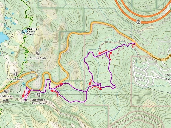
Gaia GPS, ©OpenStreetMap contributors
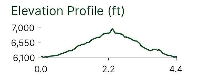
Distance: 4.4 miles
Elevation:
Min. 6100’
Max. 7000’
Where is it happening?
16395 Donner Pass Rd, 16395 Donner Pass Road, Truckee, United StatesEvent Location & Nearby Stays:
USD 0.00