Donner Lake Rim Trail Hike
Schedule
Sat Aug 24 2024 at 09:00 am to 12:00 pm
UTC-07:00Location
Glacier Way Trailhead | Truckee, CA

About this Event
This moderate hike (one steep section) will take hikers on a four-mile loop to the Drifter
Hut, which sits on a ridge top with views to the northwest of Castle Peak and Frog Lake
Cliffs, as well as a full Sierra panorama to the south. There is an ALERTWildfire camera
on the ridge. (Camera information in the “EXTRAS” section below.) The return follows
The Far Side trail (a Tahoe Donner trail) and at its highest point, 7,818 ft, you will be
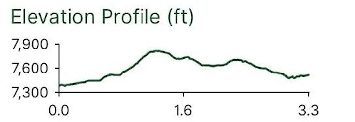
treated to phenomenal 360-degree views. There are approximately 700 ft in elevation
change. The hike can just as easily be done in the opposite direction along Donner
Ridge.
EXTRAS: The ALERTWildfire camera in Tahoe Donner was installed in July 2020 and began
broadcasting live at https://www.alertwildfire.org/region/tahoe/?camera=Axis-
TahoeDonner. It is the twelfth fire camera to be added to the North Tahoe area network
to help protect Tahoe Donner and the North Tahoe-Truckee area, which is of critical
importance during summer months when red flag warnings and thunderstorms are
common.
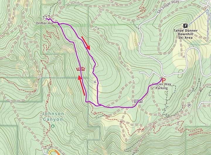
©Gaia GPS, ©OpenStreetMap contributors
Distance 3.3 miles
Elevation:
Min. 7400’
Max. 7800’
Where is it happening?
Glacier Way Trailhead, Glacier Way, Truckee, United StatesEvent Location & Nearby Stays:
USD 0.00