Bird Outing at Theodore Roosevelt Island
Schedule
Sun Mar 09 2025 at 09:00 am to 11:00 am
UTC-04:00Location
Theodore Roosevelt Island Pedestrian Bridge | Washington, DC

About this Event
Meeting Location:
We will be meeting in front of the pedestrian bridge crossing at 9 AM. The address is Theodore Roosevelt Island Pedestrian Bridge, Unnamed Road, Washington, DC 20007. There is ample parking (including four disability parking spaces and 1 van-accessible space), shared bike charging station, and four porta potties (including 2 wheel-chair accessible portapotties).
To learn more about the park check out the Birder's Guide to Maryland & DC: Theodore Roosevelt Island.
Getting there:
If you are taking the metro, the island is a 10-15 minute walk from the Rosslyn Metro Station on the Orange and Silver Lines. From the station, head north toward the base of the Key Bridge, where a short connecting trail leads downhill from the downstream side of the bridge, across the George Washington Memorial Parkway, and into the parking lot at Theodore Roosevelt Island. See detailed walking directions and a route map on Google Maps.
- Start at the Rosslyn Station, 1850 N Moore St, Arlington, VA 22209
- Head north on N Moore St toward 19th St N for 0.1 miles.
- Turn right to stay on N Moore St for 92 feet.
- Turn right onto US-29 N and continue for 112 feet.
- Turn left onto N Lynn St and continue for 295 feet.
- Turn right onto the Custis Trail and continue for 39 feet.
- Continue onto Mt Vernon Trail for 0.3 miles.
- Slight right to stay on Mt Vernon Trail. The parking area and the footbridge to the island will be on the left.
If you are biking, the northern terminus of the Mount Vernon Trail is at Theodore Roosevelt Island. A short connecting trail leads downhill from the downstream side of the Key Bridge in Virginia, across the parkway, and into the parking lot at Theodore Roosevelt Island. Because bicycles are not allowed on the island, you will need to use one of the bicycle racks near the footbridge. There is cabi bike dock, but it can get quite full.
If you are driving, plug the following into your GPS: Theodore Roosevelt Island Park, Washington, DC 20001. Alternatively, follow these directions:
Drivers can only reach Theodore Roosevelt Island from the northbound lanes of the George Washington Memorial Parkway.
After Memorial Bridge, follow the sign to turn right into the parking lot.
Carpooling:
We may be able to coordinate carpooling depending on where folks need to be picked up/dropped off. When you register, please let us know whether you need a ride.
Trail Information:
We will be going as far as we can so that we can make it back to the meeting point in two hours, with a maximum of 1.5 miles. The beginning of the trail is the paved bridge, after which the trail becomes pea gravel and dirt with exposed roots that can pose a tripping hazard. The trail is mostly flat, except for short stretches where the incline is very steep. The width of the trail varies from 10-15 feet wide to approximately 4 feet wide with some exposed roots and rocks. On the boardwalk, there are parts that are uneven with a few loose boards.
We will first head towards the monument in the middle and bird there for a little and give folks an opportunity to sit on the benches. After that there are benches for breaks on the boardwalk approximately every 5 minutes going at a slow pace. The width of the trail varies from 10-15 feet wide to approximately 4 feet wide with some exposed roots and rocks.
To see the trail path we will take, we've created a Google Earth project. We will plan to go counter-clockwise around the island.
We also have photos of what to expect on the trail in the forest, by the monument, and along the boardwalk towards the end of this event page.
Note - when we scoped out the island on 3/1/2025, there was a lot of noise pollution from the parkway and airplanes.
Outing Leaders:
For this trip, Colleen (pronouns: she/her) and Sarah (pronouns: she/her) will serve as the outing leaders.
- Sarah is on the FBC DMV leadership team and a new birder who loves to share her bird joy with everyone and build community.
- Colleen is on the FBC DMV leadership team and has been birding ever since she bought a small window feeder a few years ago - ostensibly to keep her cats entertained - and "discovered" the tufted titmouse, which remains a fave!
Point of Contact:
If you need to get in contact with us day-of, please email [email protected] or text/call the cell phone number we will share in an email later to those who register.
Code of Conduct:
Please read the FBC DMV Code of Conduct prior to the event if you haven't already. This Code of Conduct is meant to explicitly place our principles into practice, lay out what behavior is and is not acceptable from our members, participants, and our leaders, and detail how we will work to enforce those principles.
Liability Waiver:
Please print, sign, and bring the liability waiver with you to the event. If you aren't able to sign and bring it with you, no worries! We will also have copies.
Why a liability waiver? We are not a registered non-profit, and as such do not have liability insurance. This is our version of insurance for our outing leaders.
Other Important Info:
- Bring and drink water during the outing to stay hydrated, consider wearing sunscreen, and check the weather to make sure you have enough layers to stay warm.
- Binoculars and bird identification books are not necessary, but you are welcome to bring them. We'll have six pairs of binoculars to lend out and a couple bird ID books/apps to share for figuring out what birds we see and/or hear.
- Masks are not required, but we ask everyone to physically distance and to wear a mask if they need or want to.
- If you are under 18 years old, you must be accompanied by an adult to partake in the event.
If you have any questions, have any accessibility needs, or have any other thoughts, please reach out to us. We truly want to hear from you and want everyone to be able to feel bird joy to the fullest 🙂
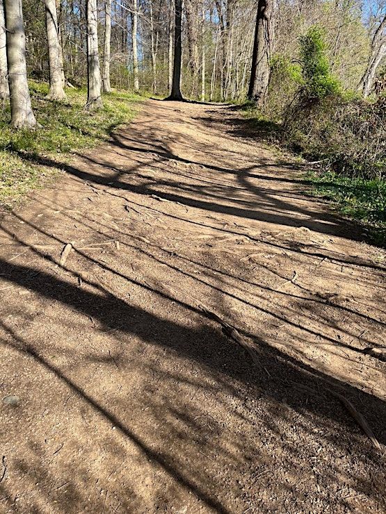
Image description: Wide dirt and gravel path with exposed roots with greenery and shrubs on both sides as well as trees.
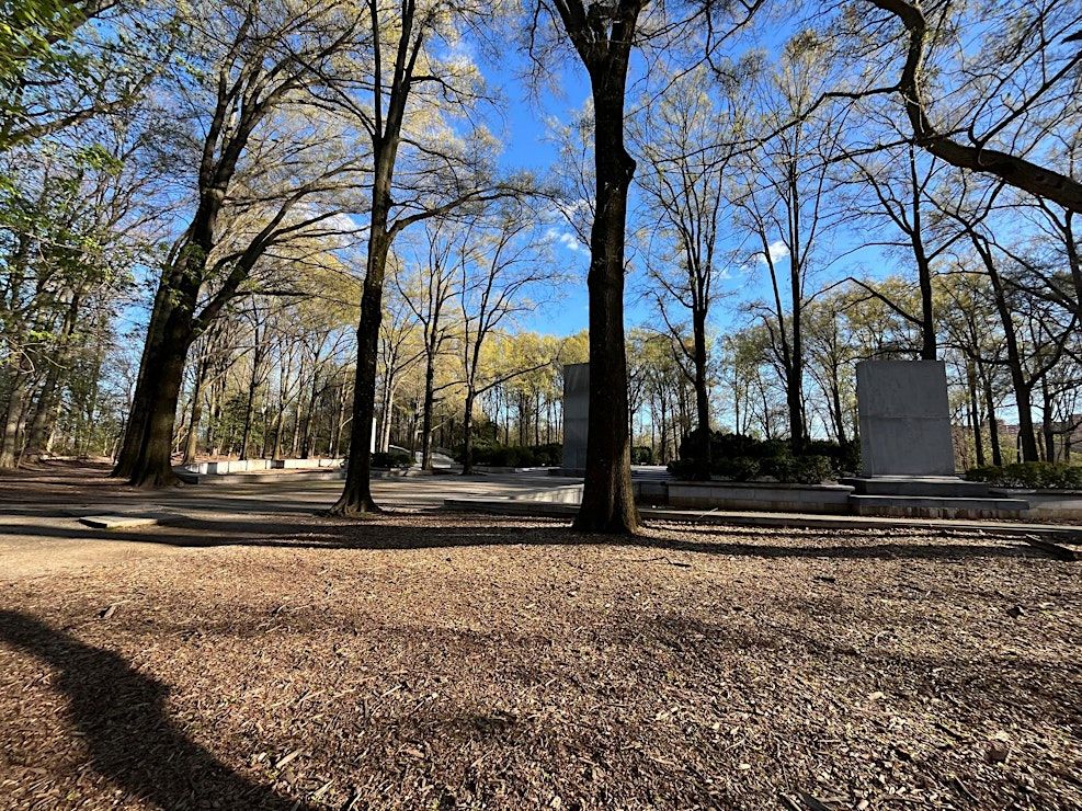
Image description: A partially mulched dirt space that is relatively flat looking out at some tall trees and stone monuments.
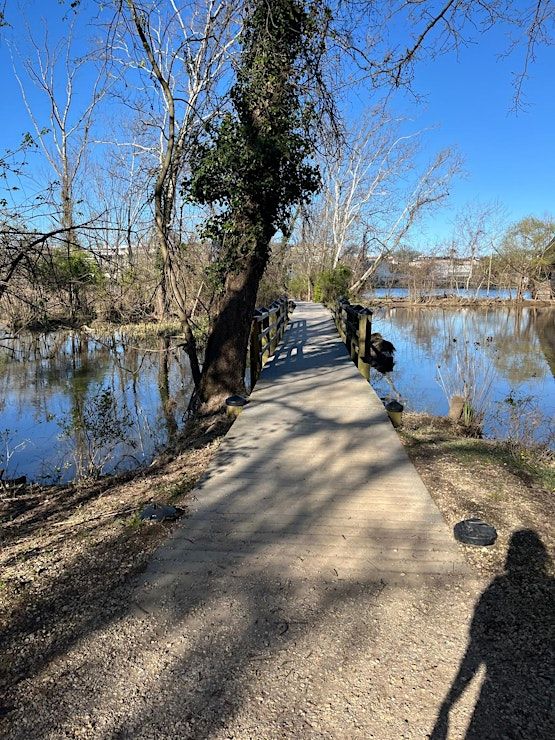
Image description: gravel dirt path turns into a boardwalk with some railings on either side approximately 10 feet in and then no longer there. Water is on either side. an trees are scattered throughout the landscape.
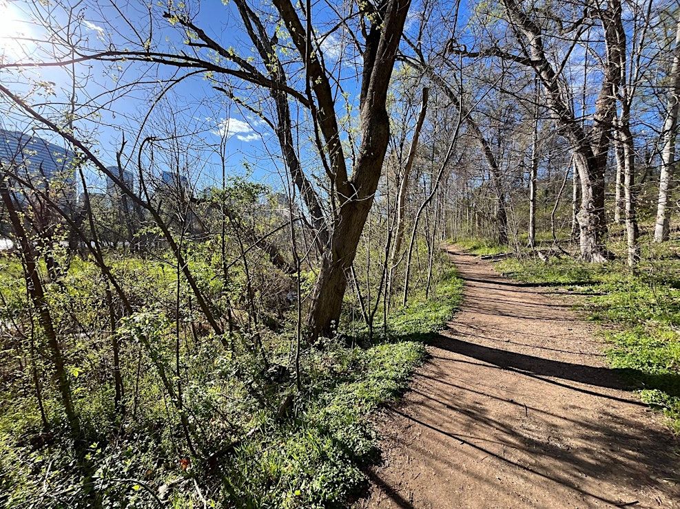
Image description: A dirt path with a small slope fades into the distance. On either side is green growth and trees starting to leaf out.
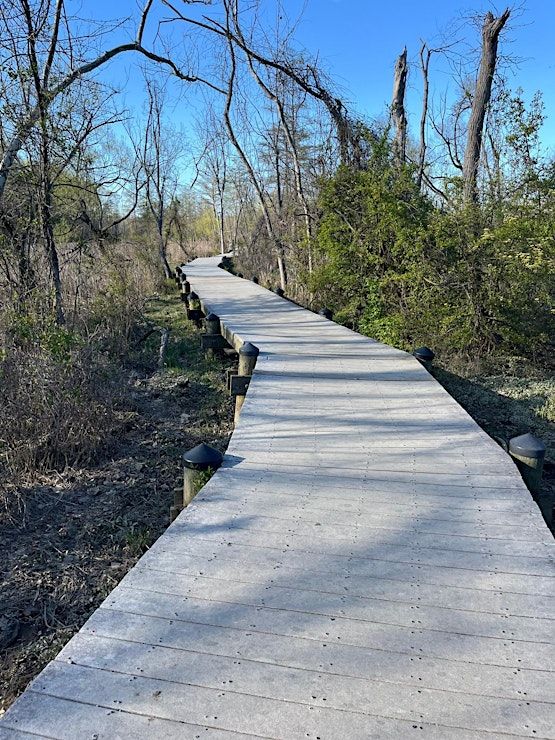
Image description: A boardwalk with no railings and brush on either side. It is relatively flat with some bowing here and there.
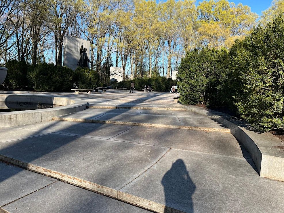
Image description: wide stone steps with benches on either stide going up in a circular pattern. Green bushes are on the outer ring of the steps, a monument is in the background along with budding trees.
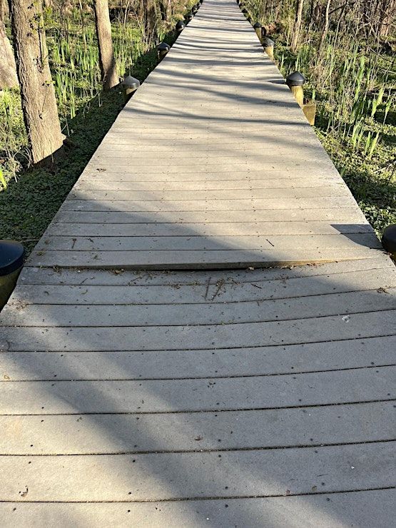
Image description: An example of how some of the boards on the boardwalk are bowing down and create an uneven surface. Most are fine, but there are occasional wear and tear ones that make the surface uneven at times.
Where is it happening?
Theodore Roosevelt Island Pedestrian Bridge, Unnamed Road, Washington, United StatesEvent Location & Nearby Stays:
USD 0.00